|
Home Page
Glen Echo
The Town
Chautauqua
Amusement Park
• Post Cards
• Souvenirs
• Tickets
• Early Programs
Modern Times
History Book
Cabin John
The Town
The Hotel
Amusement Park
The Bridge
Legends
History Book
Great Falls
Post Cards
Other Stuff
Conduit Road
The Trolleys
Buildings
The Aqueduct
The Road
General
Capital Transit Passes
Historic item Trader
Minnie Brooke Postcards
|
An early history of the Cabin John Bridge
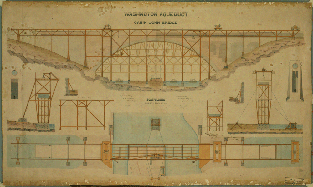
Plans for the construction of Bridge #4, the Union Arch, 1853
The Cabin John Bridge
Note: The images on this page are extensive digital processing to enhance their quality and clarity. These retouched images are copyrighted.
The previously sleepy southern town of Washington D.C. was facing difficult times by the 1850’s. The ever increasing population strained the city’s water supply to its limits.
Plans to use several small water sources including Rock Creek had been explored and found inadequate.
A reliable source of plentiful water was needed.
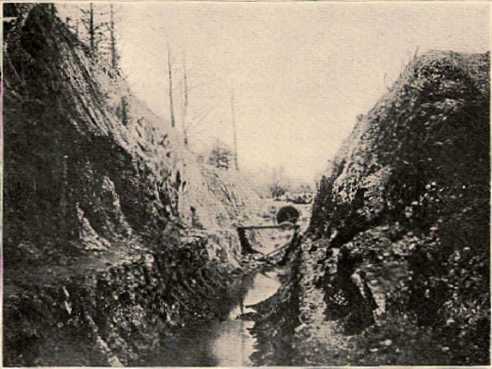
A section of the aqueduct trench in Cabin John, showing the 9 foot diameter brick aqueduct. ca. 1854
The Cabin John Bridge
The Potomac River was the most dependable source, but by the time the river reached the city it was too dirty for use due to farm runnoff from the farms in the valley and partly due to the busy port at Georgetown where all kinds of waste was simply cast into the water when no longer wanted.
A gravity fed aqueduct with an inlet above Great Falls, Maryland was proposed and adopted. Congress approved the project abd the project was under way. The land between Great Falls and the city was largely undeveloped so a relatively straight right-of-way was quickly acquired.
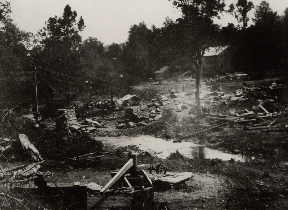
Early shot of the Cabin John creek valley cleared to make ready for the bridge construction to start. 1854
The Cabin John Bridge
For the most part the terrain sloped gently from Great Falls to Washington. Only one major obstacle stood in the way, the deep ravine of the Cabin John Creek.
The principal engineer, Major Montgomery C. Meigs, of the Army Corp of Engineers, chose a single grand arch to span the 400 foot wide valley.
Engineer Alfred Rives of Germantown,Maryland drafted the plans. Major Meigs was a proud man and throughout the project he managed to keep the focus on himself as engineer.
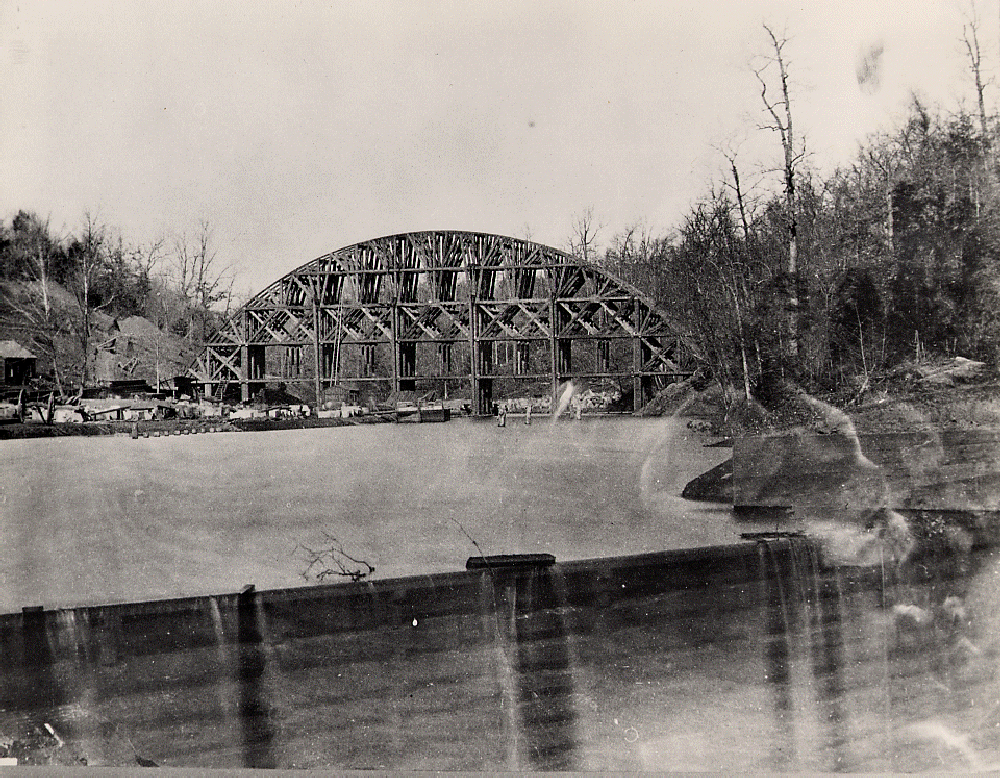
The centers before the start of setting the arch ring. Also seen is the top of the coffer-dam in the foreground. Winter 1857/58
The Cabin John Bridge
After construction began in 1853, the creek valley bottom at Cabin John was cleared and excavation for the bridge footings began. The valley sides were asymmetrical, but the bridge plans were quickly adjusted making the bridge longer on the upriver end as can be seen in the plans shown above on this page.
Several large wooden buildings were constructed to house a construction office and for other needs. A large granite building was also built on the site along with the necessary hoists and cranes.
A good source of Potomac granite was located a few hundred feet from the construction site and a quarry was dug.

The completed arch ring. Note the man silhouetted against the top of the ring! The shack below the bridge was the stone mill. December 6, 1858
The Cabin John Bridge
Transportation of materials was a challenge. the right-of-way for the aqueduct was narrow in some areas making overland transport difficult. Meigs overcame this 'roadblock' by damming the creek valley and building a lock to connect the flooded valley with the C & O Canal.
Barges could be floated right up to the bridge construction site possibly allowing the massive arch ring stones to be lifted directly into place; though most materials were offloaded at a nearby dock.
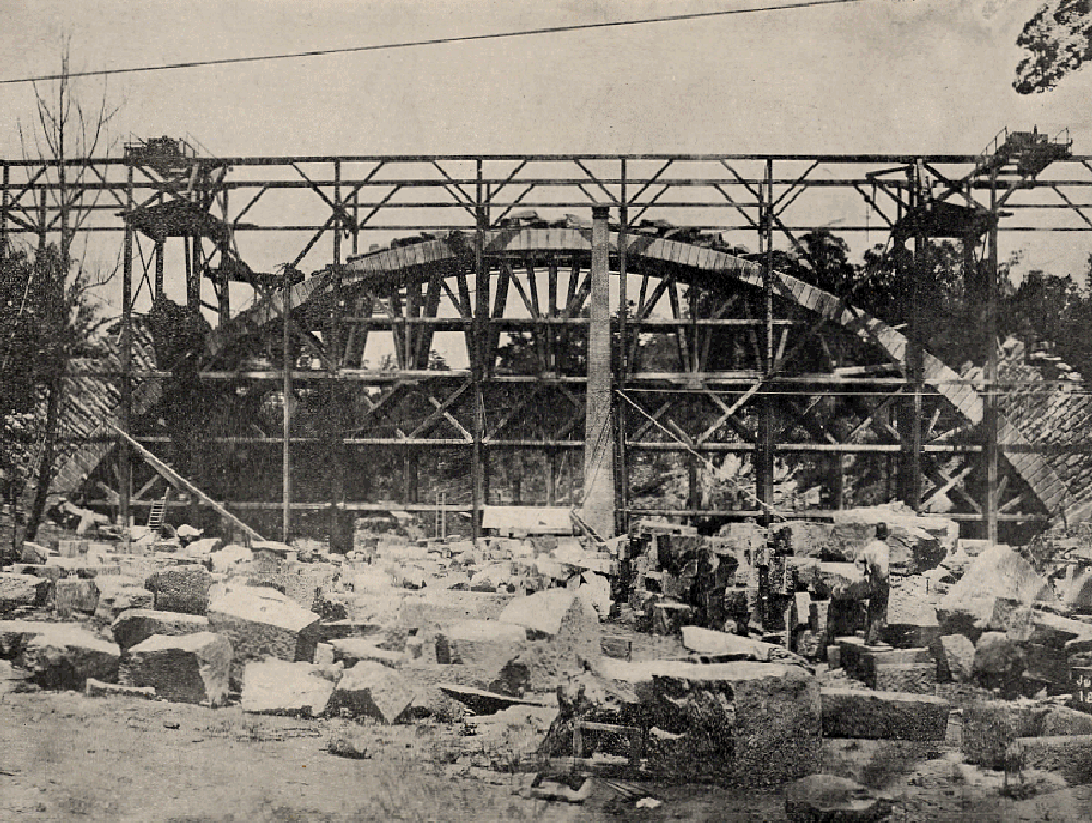
The stone yard below the bridge is where the stones were cut to size before being lifted into place. The facing walls and spandrels are just started in this image. July 1, 1859
The Cabin John Bridge
Major Meigs wanted the best materials for the bridge; the “Center” was built of oak to support the initial arch construction. Building arches over centers dates back to roman times and greatly simplifies the process of construction.
The arch ring was built of huge granite blocks from Quincy, Massachusetts. The granite was shipped by sea to Georgetown and there loaded onto barges in the harbor. The barges were locked into the C & O Canal at the mouth of Rock Creek and hauled up the canal to Cabin John where they were locked through to the flooded valley of the Cabin John creek.
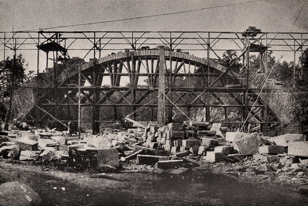
The bridge with a few more stones in place than in the prior image. July 1, 1859
The Cabin John Bridge
The bridge is not a solid structure as some might suppose; it is constructed of a series of spandrel arches, four on the Washington side and five on the Cabin John side. These arches stand on the arch ring and distribute the load of the bridge.
The spandrels are pierced by relatively small arched doorways allowing passage between the chanbers created by the arches.
The exterior of the bridge is faced with plain walls which hide the spandrels. Sadly the spandrels are not visible in the construction photos of the bridge.
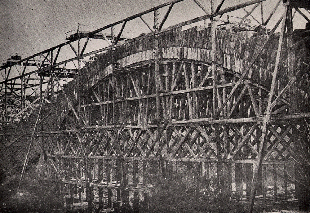
Construction progress, stonework covers the entire arch ring as the spandrel walls rise. February 27, 1861
The Cabin John Bridge
Bridge building at this time was an art. There were no off-the-shelf cranes or scaffolding, so all that was needed for construction had to be designed and build to order.
Meigs and Rives designed everything down to the rolling carriages that rode on rails at the top of the external scaffold and were used to place the stones.
Everything really meant everything, they even designed the wheels and axles for the carriages and had them custom made.
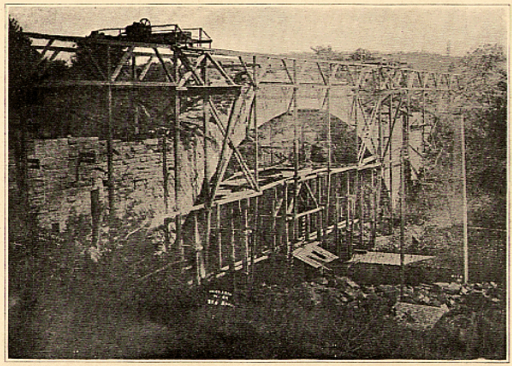
The condition of the work just before the dedication plaque was added. Summer 1861
The Cabin John Bridge
The image to the right clearly shows the carriages atop the scaffolding. The scaffolding enclosed the bridge structure but did not extend under the bridge. The centers were almost completely under the bridge and the two were independent.
It was about at the stage shown here that the dedication plaque was mounted into the wall of the bridge.
The plaque was not for the bridge, but was the dedication plaque for the entire aqueduct, which shows the importance that Meigs placed on this bridge.
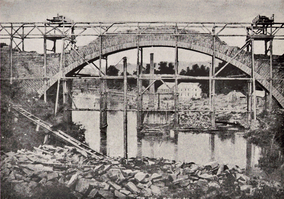
An unusual shot taken looking downstream over a stone pile. August 12, 1861
The Cabin John Bridge
Throughout to history of the Cabin John Bridge, nearly all photographs have been taken looking up the creek. As teh valley is wider on that side images are generally better. The image on the right is one of the few taken looking downstream.
Under the bridge you can see the smokestack of the stone mill and several of the construction buildings.
At this stage of construction, the centers were removed, having served their purpose. It is also stated in several histories that they were removed to prevent confederate soldiers from setting fire to the centers and destroying the bridge.
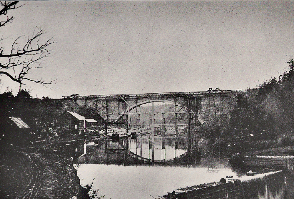
The nearly finished bridge right after the center was removed. December 5, 1863
The Cabin John Bridge
Water was first run through teh aqueduct while the scaffolding was still in place. A quick run through helped locate several small leaks and the water was turned off to permit stopping the leaks.
The aqueduct went into service and has continued to supply Washington D.C. with water to this day.
In the midst of the Civil War the name of Jefferson Davis (U.S. Secretary of War turned President of the Confederacy) was chisled off the dedication plaque. More on that on the Cabin John main page.
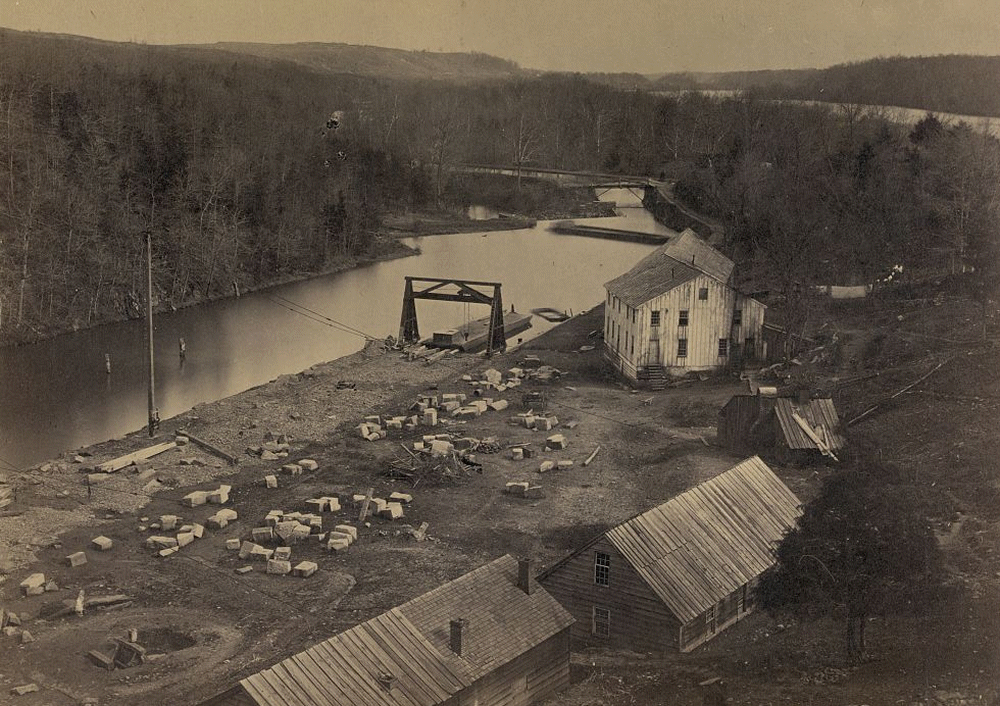
Looking down from atop the bridge onto the work yard, dock, lock, and coffer-dam. ca. 1863
The Cabin John Bridge
As was mentioned above, much of the valley was cleared during construction. The stone yard and buildings can be seen in the image on the right. A unloaded barge sits at the dock and the lock connecting the C & O Canal can be seen in the distance. The Potomac River can be seen among the trees beyond the canal, as well as a mule bridge over the creek.
Most of the construction buildings did not last long after construction ended. The abandoned wooden buildings disappeared over the next 10 or so years. Only the large stone structure which is not seen in this image lasted beyond 1875.
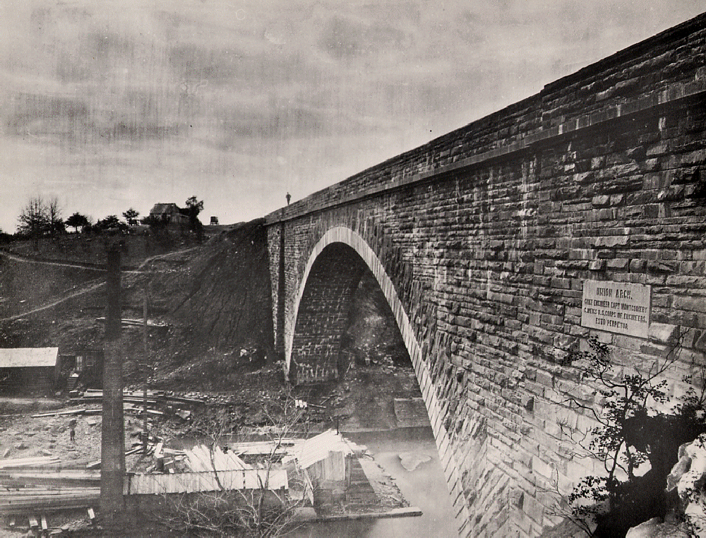
The bridge just after completion, note the carriages around the shack on the hilltop. The shack stands where the Cabin John Bridge Hotel will be built a few years later. Winter 1864/65
The Cabin John Bridge
The newly finished bridge is seen here. The shack at the top of the hill sits where the Cabin John Bridge Hotel would be built six years later. More than likely the shack was used as a station and tie-up for carriages and horses. Carriages can be seen to either side of the shack.
The bridge was built to carry the aqueduct, not for traffic. Nonetheless it was by far the best way to reach Cabin John. The bridge had no parapet when built, only railroad tie size logs staked along the edges of the bridge. The man standing on the bridge shows the lack of a parapet clearly.
The parapet was not added until 1872 which helps in dating early photos.
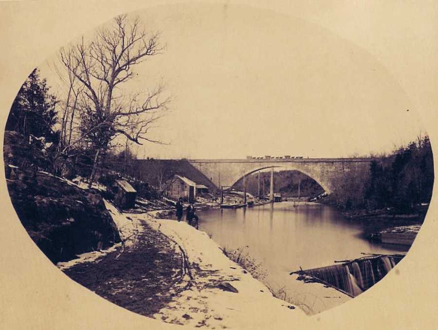
A nice view of the entire creek valley during winter. 1865
The Cabin John Bridge
The newly finished bridge is shown here with the flooded creek valley in the foreground. At the bottom right the coffer-dam that held back the creek is shown.
Normally the creek flows through a culvert under the C & O Canal and into the Potomac River. The coffer dam acted as a flow control, routing adequate water to the locking system that connected to the canal; with excess water flowing over the dam and back into the original creek bed.
The abandoned construction buildings are still standing in this shot.
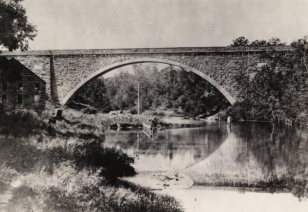
Remains of the construction buildings along the creek banks. ca. 1869
The Cabin John Bridge
For some years after completion the coffer-dam remained in place. The buildings, dock, and cranes were left to rot in the creek valley.
The photo to the right shows the deteriorating structures around 1869, the valley still flooded by the coffer-dam.
The bridge has its own plaque besides the aqueduct dedication plaque. Both can be seen in the image at right; the Aqueduct plaque on the left side above the building and the bridge plaque above the trees on the right.
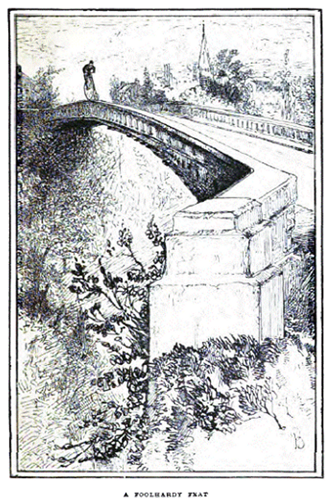
A 'big-wheel' bicycle being ridden atop the bridge's parapet in 1884.
The Cabin John Bridge
The addition of the parapet in 1872 made the bridge more 'user-friendly', prior to the addition some horses (and perhaps a few people) simply refused to cross the bridge without sides.
The addition brought about at least one unexpected consequence; almost immediately, dare-devils began walking across the bridge atop the parapet. In 1884 the first recorded bicycle crossing on the parapet top was recorded in the local newspapers. The story quickly became quite famous and the etching on the right was included in a national publication later the same year.
This dare-devil feat was repeated many times over the years, up until at least the 1960's by several Cabin John youngsters. The addition of iron railings on top of the parapet finally brought the practice to an end.
|
|


